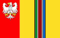
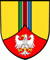
Łowicz County (powiat łowicki) is a unit of territorial administration and local government (powiat) in Łódź Voivodeship, central Poland. It came into being on January 1, 1999, as a result of the Polish local government reforms passed in 1998. Its administrative seat and only town is Łowicz, which lies 48 km north-east of the regional capital Łódź.
The county covers an area of 987.13 km2. As of 2006 its total population is 82,338, out of which the population of Łowicz is 30,204 and the rural population is 52,134.
Łowicz County is bordered by Sochaczew County to the north-east, Skierniewice County to the south-east, Brzeziny County to the south, Zgierz County to the south-west, Łęczyca County and Kutno County to the west, and Gostynin County to the north-west.